 |
Ozi Explorer (Popularity:  ) )
http://www.oziexplorer.com/
GPS mapping software for Magellan, Garmin, Lowrance, Eagle, and MLR receivers.
Category:
Shopping - Consumer Electronics - Global Positioning System
|
 |
The Map Shop (Popularity: )
http://www.themapshop.com/
Offers maps, nautical charts, globes, travel guides, satellite imagery, flags, geography games, custom mapping, USGS maps, and related items. Products, services, and map facts.
Category:
Shopping - Publications - Maps
|
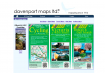 |
Davenport Maps Ltd. (Popularity: )
http://davenportmaps.com
Specializes in maps covering British Columbia, Greater Vancouver, and Vancouver Island, Canada. Also offers custom mapping services.
Category:
Shopping - Publications - Maps
|
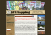 |
GTR Mapping (Popularity: )
http://www.gtrmapping.com/
Publishes topographical recreational maps, geologic highway maps, and national park maps for areas in Rocky Mountain states. Product descriptions, detailed images, and quantity discount schedule.
Category:
Shopping - Publications - Maps - Publisher-direct
|
 |
Gpsy (Popularity: )
http://www.gpsy.com/
Macintosh GPS communications and GIS mapping software compatible with any NMEA-0183 compatible GPS/Loran-C/DECCA or other navigational system. Demo download available.
Category:
Shopping - Vehicles - Watercraft - Parts and Accessories
|
 |
Related:
Cs-mapping
- Mapping Help
- Cause Mapping
- Strategic Mapping
- Mapping Service
Ocean Mapping Group (Popularity: )
http://www.omg.unb.ca
Ocean mapping Geo-Information Systems (GIS) are a promising tool for the management of high volume bathymetry data, the more extensive data management requirements of bathymetric charting agencies, and the information searches of ocean scientists, environmental ...
Category:
Science - Technology - Acoustics, Ultrasound and Vibration - Ultrasound
|
 |
MineGeo Mine Site Geology Mapping Software (Popularity: )
http://www.minegeo.com
Develops and markets CAD-based software for 3D data capture in underground and open cut mines.
Category:
Science - Technology - Mining - Software
|
 |
4D SOLUTIONS (Popularity: )
http://www.4d.com.au/
Integrated terrain modeling and civil works software package used in surveying, land subdivisions, drainage, earth moving, landscape design, mapping and mining applications.
Category:
Science - Technology - Civil Engineering - Geotechnical
|
 |
USGS Astrogeology Research Program (Popularity: )
http://astrogeology.usgs.gov/
Features planetary imagery, research, GIS, mapping, and image processing software. Offers data from a variety of space mission.
Category:
Science - Technology - Space - Missions
|
 |
MicroBrightField Inc. (Popularity: )
http://www.stereoinvestigator.com/
System for 3-D incremental imaging, stereology and anatomical mapping.
Category:
Science - Instruments and Supplies - Laboratory Equipment - Microscopes
|
 |
Air Photo Services (Popularity: )
http://www.airphotoservices.co.uk/
Specialize in aerial photographic interpretation, rectified mapping from aerial photographs, CAD and GIS solutions and aerial photography. Services, cases studies, clients, staff.
Category:
Science - Social Sciences - Archaeology - Contractors and Consultants
|
 |
Versamap Digital Mapping (Popularity: )
http://www.versamap.com/
Versamap draws outline maps on many map projections. Print publication quality maps, or export maps in vector graphic (WMF, CGM, DXF, ASCII) and bitmapped (BMP) formats. Text may be added to maps using any Windows font. Plot your own data in a simple ...
Category:
Science - Social Sciences - Geography - Cartography
|
 |
Lovell Johns Limited (Popularity: )
http://www.lovelljohns.com/
Mapping Information Specialists Map making of all types and have developed own map databases
Category:
Science - Social Sciences - Geography - Cartography
|
 |
Wild Life Mapping (Popularity: )
http://www.wildlifemapping.org/
Provide accurate mapping for the conservation and sustainable management of wildlife
Category:
Science - Social Sciences - Geography - Cartography
|
 |
Falcon (Mapping) Ltd (Popularity: )
http://www.falmap.com
The independent cartographic company which offers a complete cartographic design and draughting service. As an example we are giving the public a free print of a Falcon (Mapping) Ltd copyright map of Edinburgh.
Category:
Science - Social Sciences - Geography - Cartography
|
 |
Digital Cartographics (Popularity: )
http://www.digitalcarto.com
Specializing in custom mapping and geographic information services. Cartography design for publication, presentation and the Web.
Category:
Science - Social Sciences - Geography - Cartography
|
 |
Golf Mapping (Popularity: )
http://www.golfmapping.com
GPS service is an efficient method of gathering a complete data set of a golf course. The data set provides all the information that is critically important to a course's successful development and management.
Category:
Science - Social Sciences - Geography - Geographic Information Systems
|
 |
ESRI (Popularity: )
http://www.esri.com/
Offers free software, online mapping and GIS training, demos, data, product and service information, user scripts, and related information. Makers of ArcView, ArcGIS and ArcIMS.
Category:
Science - Social Sciences - Geography - Geographic Information Systems
|
 |
VDS Technologies (Popularity: )
http://www.vdstech.com/
Offers Internet/intranet GIS and mapping components for Web developers.
Category:
Science - Social Sciences - Geography - Geographic Information Systems
|
 |
Geocart mapping software (Popularity: )
http://www.mapthematics.com/
Map projections program for Macintosh computers. Offers tools for creating and manipulating maps.
Category:
Science - Social Sciences - Geography - Geographic Information Systems
|
|


