 |
Base Mapping (Popularity:  ) )
http://www.basemap.ca/
Provide mapping services such as digital terrain analysis, orthophotos, photogrammetry, aerial photography and scanning working with public, private and government sectors.
Category:
Science - Earth Sciences - Geomatics - Photogrammetry
|
 |
EOI Ortho International (Popularity: )
http://www.eoi.ie/
Providing services in survey, mapping, digital mapping, aerial survey, ortho, orthophoto, photogrammetry, and terrestrial. Located in Dublin, Ireland.
Category:
Science - Earth Sciences - Geomatics - Land Surveying
|
 |
Photogrammetry Projects (Popularity: )
http://www.gis-cad.com/projects.html
Toyo Computers are the best photogrammetry project consultants in the business. Our digital photogrammetry solutions include Aerial Triangulation, 3D Model Generation and Color Balancing.
Category:
Computers - Internet
|
 |
DAT/EM Systems International (Popularity: )
http://www.datem.com/
Software for digital mapping and photogrammetry.
Category:
Science - Earth Sciences - Geomatics - Photogrammetry
|
 |
Tricad (Popularity: )
http://www.tricadinfo.com/
Provide services in CAD, GIS, RS, AM/FM, digital photogrammetry, e-mapping and related spatial information technologies.
Category:
Science - Earth Sciences - Geomatics - Products and Services
|
 |
Related:
Photogrammetry
- Digital Photogrammetry
- Architectural Photogrammetry
- Close-range Photogrammetry
- Mapping
Leica Geosystems (Popularity: )
http://www.leica-geosystems.com/
Offers solutions for positioning, surveying, mapping, navigation, industrial and other applications. Systems include GPS, total stations, GIS, photogrammetry, aerial cameras.
Category:
Science - Earth Sciences - Geomatics - Land Surveying
|
 |
Vexcel Corporation (Popularity: )
http://www.vexcel.com/
International remote sensing company with technical areas of expertise including synthetic aperture radar, satellite data processing and ground stations, mapping, GIS and photogrammetry.
Category:
Science - Earth Sciences - Geomatics - Remote Sensing
|
 |
Noobeed (Popularity: )
http://noobeed.com/
An interactive geomatic object oriented language for spatial modeling, image processing, remote sensing, digital photogrammetry, geographic information system (GIS), geodesy, and surveying and mapping.
Category:
Computers - Programming - Languages - Object-Oriented
|
 |
Aerial Oklahoma, Inc. (Popularity: )
http://www.aerialok.com/
Aerial photography, photogrammetry, digital and analog mapping services. Oklahoma City, OK
Category:
Science - Earth Sciences - Geomatics - Photogrammetry
|
 |
Ordnance Survey Britain's National Mapping Agency (Popularity: )
http://www.ordnancesurvey.com
Maps and mapping for Great Britain, with free mapping and services together with information on digital and paper mapping products and other aspects of cartography
Category:
Science - Social Sciences - Geography - Cartography
|
 |
Flat Earth Mapping (Popularity: )
http://www.flatearthmapping.com.au/
Flat Earth Mapping is an Australian company providing cartography and custom mapping services. Established in 1998 to supply custom made maps of all kinds to the publishing industry, Flat Earth. John Frith is the cartographer behind Flat Earth Mapping ...
Category:
Business - Business Services
|
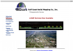 |
Gulf Coast Aerial Mapping Inc. (Popularity: )
http://www.gcam-maps.com/
Offer aerial photography, parcel mapping, and digital mapping. Includes a demonstration of how stockpile volumes are calculated. Baton Rouge, La.
Category:
Science - Earth Sciences - Geomatics - Photogrammetry
|
 |
Institute of Geodesy and Photogrammetry (IGP) (Popularity: )
http://www.igp.ethz.ch/
Included events and announcements, a list of publications, curriculum, links to the Institute of Cartography and Department of Civil, Environmental and Geomatics Engineering as well as the following departments: Geodesy and Geodynamics, Photogrammetry ...
Category:
Reference - Education - Colleges and Universities - Europe
|
 |
Gis Jobs Australia (Popularity: )
http://www.ebr.com.au
EBR is Australia's #1 GIS and Spatial jobs specialists. Our core strength lies in the GIS/spatial industry, so if you are looking for a career in professions such as Land & Hydrographic Surveying, Cartography, GIS (GIS Officers, GIS Analysts), Mapping ...
Category:
Business - Employment - Job Search
|
 |
Advanced Mapping Technologies (AMT) (Popularity: )
http://www.amtmaps.com/
Provides aerial photography, digital mapping, aerial mapping, digital orthophotography, aerotriangulation, topographic maps. Two offices in Michigan, Port Huron and Traverse City.
Category:
Science - Social Sciences - Geography - Geographic Information Systems
|
 |
New World Mapping (Popularity: )
http://www.newworldmapping.com/
GIS hydrologic feature mapping. Irrigation feature mapping. GPS Location and digital image hotlinking in Arcview. Military trained image interpretor Lowrey AFB CO, 1976. Worked with Bureau of Reclamation.
Category:
Science - Social Sciences - Geography - Geographic Information Systems
|
 |
Highland Mapping (Popularity: )
http://www.highlandmapping.com/
Highland Mapping is a GIS consulting and custom mapping firm based in Foscoe, North Carolina. We do custom cartographic products and utilize GIS technology
Category:
Science - Social Sciences - Geography - Geographic Information Systems
|
 |
Human Brain Mapping (Popularity: )
http://www.humanbrainmapping.org/
The Organization for Human Brain Mapping (OHBM) has evolved in response to the explosion in the field of human functional neuroimaging. Provides an educational forum for Human Brain Mapping research exchanges.
Category:
Science - Technology - Biomedical Engineering
|
 |
Temperature Data Collection Services Ltd. (Popularity: )
http://www.tedac.co.uk/
TeDaC who offer a full Temperature mapping survey service for all types of storage facility like warehouse temperature mapping, server room temperature mapping etc. This is particularly applicable to the pharmaceutical industry. MHRA, IMB and FDA regulations ...
Category:
Business - Electronics and Electrical
|
 |
Wild Life Mapping (Popularity: )
http://www.wildlifemapping.org/
Provide accurate mapping for the conservation and sustainable management of wildlife
Category:
Science - Social Sciences - Geography - Cartography
|
|


