 |
Alpha Omega Engineering, BioMedical Division (Popularity:  ) )
http://www.alphaomega-eng.com/
Instruments for recording and analyzing electrical activity from the brain and the nervous system. Spike sorting, data acquisition, microelectrode amplifiers, microelectrode manipulators.
Category:
Science - Technology - Biomedical Engineering - Laboratory Equipment
|
 |
4D SOLUTIONS (Popularity: )
http://www.4d.com.au/
Integrated terrain modeling and civil works software package used in surveying, land subdivisions, drainage, earth moving, landscape design, mapping and mining applications.
Category:
Science - Technology - Civil Engineering - Geotechnical
|
 |
CEDRA Corporation (Popularity: )
http://www.cedra.com/
Provides services for the conversion of hardcopy drawings into digital form along with database and application development. Maps and drawings can be converted into vector or raster digital format. Description of software and application examples.
Category:
Science - Technology - Software for Engineering
|
 |
Blue Marble Geographics (Popularity: )
http://www.bluemarblegeo.com/
Offer freeware program for viewing DGN, DWG, DXF, TAB, and MIF files.
Category:
Science - Social Sciences - Geography - Software
|
 |
CARIS Geographic Information Systems (Popularity: )
http://www.caris.com/
Supports raster, vector and dimensional data, cartography, map projections, topology and digital terrain modeling.
Category:
Science - Social Sciences - Geography - Geographic Information Systems
|
 |
Related:
Raster Mapping
- Raster Image
- Raster To Cad
- Raster To Vector
- Raster Maps
MFworks by Thinkspace (Popularity: )
http://www.thinkspace.com/
Raster GIS with image processing and spatial analysis functions.
Category:
Science - Social Sciences - Geography - Geographic Information Systems
|
 |
PCI Geomatics Group (Popularity: )
http://www.pcigeomatics.com/
Geomatica software for remote sensing, image interpretation, digital photogrammetry, GIS, cartography and data visualization.
Category:
Science - Social Sciences - Geography - Geographic Information Systems
|
 |
Hudsal (Popularity: )
http://www.husdal.com/
MFworks is raster GIS that can do vector-like network analysis.
Category:
Science - Social Sciences - Geography - Geographic Information Systems
|
 |
CEDRA Corporation (Popularity: )
http://www.cedra.com/
Provides services for the conversion of hardcopy drawings into digital form along with database and application development. Maps and drawings can be converted into vector or raster digital format. Description of software and application examples.
Category:
Science - Social Sciences - Geography - Geographic Information Systems
|
 |
OpenEV (Popularity: )
http://openev.sourceforge.net/
An open source library and reference application for viewing and analysing raster and vector geospatial data. Handles raster and vector data, 2d and 3d display, and other image processing tools. (free, with code) [Win32, Unix, SGI]
Category:
Science - Social Sciences - Geography - Geographic Information Systems
|
 |
EZClick Tools Extension for ArcView 3.x (Popularity: )
http://raynerhoward.com/
Tool for building spatial indexes for geographic vector and raster data distributed over various directories. Helps to quickly load and manage data for any given window. Shareware.
Category:
Science - Social Sciences - Geography - Geographic Information Systems
|
 |
Energisite.com (Popularity: )
http://www.energisite.com/
Internet delivery of online digital and raster well logs, well data, GeoCadd culture, and Analytical software using esri and AutoDesk MapGuide and AnGIS technologies.
Category:
Science - Social Sciences - Geography - Geographic Information Systems
|
 |
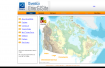
Louisiana Statewide GIS (Popularity: )
http://atlas.lsu.edu/
Contains GIS and mapping data on the state of Louisiana.
Category:
Science - Social Sciences - Geography - Geographic Information Systems
|
 |
Mid-Continent Mapping Center (Popularity: )
http://mcmcweb.er.usgs.gov/
Production, research, and data management facility for United States maps and digital cartographic data products.
Category:
Science - Social Sciences - Geography - Geographic Information Systems
|
 |
TerraSoar (Popularity: )
http://www.coresw.com/
Modular UNIX-based software system for interfacing databases with specific functionality geared toward the querying of geospatial data.
Category:
Science - Social Sciences - Geography - Geographic Information Systems
|
 |
The PCI Geomatics Group (Popularity: )
http://www.pci.on.ca/
Remote Sensing, spatial Analysis, photogrammetry, and cartography Software.
Category:
Science - Earth Sciences - Geomatics - Remote Sensing
|
 |
PCI Geomatics (Popularity: )
http://www.pcigeomatics.com/
Software provider for remote sensing, photogrammetry, cartography, spatial analysis, and GIS.
Category:
Science - Earth Sciences - Geomatics - Remote Sensing
|
 |
Stitches Creation (Popularity: )
http://www.stitchescreation.com/
Offers digitizing and embroidery services. Based in Canada.
Category:
Business - Marketing and Advertising - Advertising - Promotional Products
|
 |
Astrabiz Cyberspace (Popularity: )
http://www.nps.net/
AutoCAD draftsman specializing in architectural and mechanical CAD design and conversion services.
Category:
Business - Construction and Maintenance - Design - Drafting Services
|
 |
H-K Resources Pte Ltd. (Popularity: )
http://www.hk-resources.com/
One-stop drafting solutions provider for architectural, civil, structural, mechanical and electrical drawings.
Category:
Business - Construction and Maintenance - Design - Drafting Services
|
|


